Monday 1 April 2013

Urban Policies in Spanish America


Despite centuries of conquestial inclination to order and partition newly occupied territory, the urban phenomenon of orthogonal grid planning was not theoretically confirmed until the sixteenth century, when the Spanish Crown developed a complex set of “Settlement Ordinances,” relating to how to found and build colonial cities. Decreed in 1573, these laws formed part of a larger body of legislative policies known as the Laws of the Indies, issued to regulate social, political and economic life within Spanish imperial possessions. 

Detailed instructions catered to each facet of community creation; city locations were to be selected based maximum potential for land utilization, city-scapes were to be organized according to a strict physical, spiritual and social order, and natives were to be dealt with according to “pacification” techniques. The "Settlement Ordinances" were based on the culmination of successful settlement strategies, and essentially formulated practical ways in which to establish efficient, prosperous and obedient colonial cities. 

The specific criteria outlined by the Spanish makes it possible to visualize this potential ideality of Spanish urban form: newly founded cities would be established on elevated, fertile land, navigable by both land and sea; special attention would paid to the influence of urban design, with the Ordinances decreeing use of a cord and ruler to divide the plan into squares of specific proportions; plazas were to be at the center of the town, oriented to accommodate social and cultural practices; while churches would be distributed evenly, with the main temple in isolation to give it authority.

The urban development techniques outlined within the Laws of the Indies construct a colonial city based on practical strategy, organized in a way that would spatially reiterate an imperial sense of order.   


WORKS CITED:
Gasparini, Graziano. The Spanish American Grid-Plan: The Urban Bureaucratic Form

Wednesday 20 March 2013

Development of Urbanism in Granada, Spain

Elaborating on our theme of how distinctive architecture and urban planning can be designed to assert and maintain dominance of the ruling class, we will be exploring the architectural strategies employed by the Spanish monarchy following the Reconquista of Granada, Spain.
We will witness the dramatic transformation in structural design and organization by considering the relationship between the old city of Granada and its peripheral town, Santa Fe de Granada, which was constructed contemporaneously with the 1492 Spanish repossession of Islamic occupied territory.

Granada
The Catholic Spanish kingdoms of Aragon and Castille were united through the marriage of King Ferdinand and Queen Isabella. The monarchs brought the Reconquista to an end when the last Muslim ruler in the region surrendered complete control of the Emirate of Granada to the Spanish crown.  Immigrants from Castille and the like repopulated Medieval city, helping it to develop a more Catholic character.
As we discovered through their colonial urban practices in Tenochtitlan, the Spanish utilized the destruction and re-construction of architecture to erase former cultural identity and influence of the conquered society. Making no exception for Granada, Muslim places of worship were reformed, while new structures and small squares were incorporated to transform the cityscape; the primary mosque was converted into a monumental cathedral (Figure 1), and a Christian palace was constructed within the heart of the former Islamic fortress complex, the Alhambra (Figure 2).  

Figure 1: the Cathedral Granada dominates its surrounding buildings in scale.
The legacy of Islamic art, however, influenced an architectural heritage rich in pattern and surface ornament (Figure 2), which was combined with motifs of ‘Isabelline Gothic’ (named for the Queen).  This new style of Spanish architectural vocabulary was necessary to construct a common Catholic identity and visual presence of the monarch in Granada (Figure 3).
These aesthetics of conveying political superiority is epitomized in the grand monuments and organized layout of Santa Fe de Granada, constructed ex nihilo just a few miles outside of the city of Granada.

Figure 2: Courtyard in the Alhambra exhibits the detailed ornamentation of Islamic architecture which heavily influenced the architectural traditions of Granada.

Figure 3: the Royal Coat of Arms embellished into the Cathedral Grenada reasserts the visual omnipresence of the monarchy.

Santa Fe de Granada

During the initial siege of Granada, Santa Fe was established as a provisional military camp, its layout drawn up according to the efficient Roman grid-plan.  It was spatially organized in the shape of a cross, valued for its Christian symbolic potential.  Santa Fe’s implementation of the plaza mayor (Figure 4) as a principle location for religious, mercantile and government institutions is reminiscent of the strategic central location of the Forum constructed in Timgad, as compared to its more organically organized counterpart in Rome.  Reference to the relationship between these two Roman cities (as discussed in our previous post) parallels motivations for their urban planning methods with Santa Fe and Granada, respectively.

The new method of urban design used in constructing Santa Fe functions to control citizens, give physical order to the lands and emphasize the significance of the church or monarchy. The plaza design opens up a new vantage point from which to view the strategic monumental buildings adorning the square, which in Granada were intermixed within the streets and oriented around main intersections (Figure 5). 

Figure 4: the Plaza de Espana, Santa Fe, Granada, isolates the Church of EncarnaciĆ³n from its surroundings, emphasizing its authority. The open space in front of the Cathedral also offers an untarnished view of its facade.
Figure 5: the Casa de Castril in Granada's facade cannot be captured in its entirety from a central location, due to the lack of space in front of the structure.


WORKS CITED
Escobar, Jesus. "Toward an Urbanismo Austriaco: An Examination of Sources for Urban Planning in the Spanish Habsburg World." Urban Modern Urbanism and the Grid: The Low Countries in International Context. Brepols Publishers, 161-175, 2011. 

http://wikitravel.org/en/Granada_%28Spain%29 


IMAGES: 
Figure 1: http://en.wikipedia.org/wiki/File:Cathedral_%26_Capilla_Real_Granada_Spain.jpg
Figure 2: http://www.odt.co.nz/files/story/2009/04/the_alhambra_in_granada_spain__1999063863.jpg
Figure 3: http://www.visualphotos.com/photo/2x4698861/spain_andalusia_andalucia_granada_architecture_art_cathedral_u18699698.jpg
Figure 4: http://www.andalucia.com/province/granada/santafe/home.htm
Figure 5: https://blogger.googleusercontent.com/img/b/R29vZ2xl/AVvXsEgGLa2jD6larTwMslF9OVgaWH5TGXo5QIrcKUFncrptGuLj-N_VH7ALBQc82g6sfaXXBC5lVe_ClzGnRX-e3BKi-6h0TWylcek8mvxIfs8EY6ofCAvUfOeVJ8eyrWguG4OdpakDmr8CUnQn/s1600/Granada_casa_castril_museo_arqueo3.jpg

Friday 8 March 2013

Resurrecting Tenochtitlan

Colonial motivations for constructing imposing ideological forms and monuments in conquest cities has been explored in the previous weeks, acquainting us with how architecture and urban planning can function to implement and signify political control. The symbolic design of these built forms can be retrospectively confirmed through this week's discussion: Spain's political motivations for the systematic destruction of the Aztec imperial capital, Tenochtitlan.

Remnants of the once great capital were entombed beneath the modern constructions of Mexico City (Figure 1). Excavations of this site have offered us information from which to render Tenochtitlan back to its original orientation and glory (Figure 2).  Archaeological analysis has confirmed that the Sacred Precinct of the Plaza Mayor enclosed the most important temples, shrines, palaces and Aztec state religious buildings.  This walled-in precinct deliberately diverged from typical Aztec city-planning standards in order to emphasize its importance and innovation.

Figure 1: Excavation of Mexico City reveals evidence of Tenochtitlan.
Figure 1: Rendering of Tenochtitlan's city-plan.

Fifteenth-century Spanish methods of domination were designed to erase former cultural identity and influence of the indigenous populations. The radical political transformation that took place in Mesoamerica during this time was reinforced by this decimation of Aztec building constructions.
Targeting the imperial capital of Tenochtitlan, the Spanish effectively represented their domination by practically razing the city, removing material evidence of Aztec identity and legitimate power.

The former Tenochtitlan's basic layout was preserved (Figure 3), providing the foundation upon which the Spanish strategically rebuilt architectural forms to assert their superiority over the indigenous population. Aiming for maximum effect in terms of imposition and orientation of surrounding buildings, the main temple complex at Tenochtitlan was dismantled and replaced by cathedrals and colonial palaces that served the ambitions of the Spanish crown (Figure 4).

Figure 3: Present-day layout of the former Tenochtitlan location.
Figure 4: Mexico City's main square currently rests atop of Tenochtitlan's original plaza and market.


IMAGES
Figure 1: http://farm5.staticflickr.com/4052/4632110046_c693c61c8d_z.jpg
Figure 2: http://www.vivamexico.info/Peintures/Autre/Plan-de-Tenochtitlan.jpg
Figure 3: http://img.weburbanist.com/wp-content/uploads/2012/05/mexicaltitan-top.jpg
Figure 4: http://en.wikipedia.org/wiki/File:Zocalo_Panorama_seen_from_rooftop_restaurant.jpg

Friday 1 March 2013

Comparison of Tula and Chichen Itza


Scholarly interpretation of a Toltec-Maya congruity—epitomized in the temple complexes of Tula and Chichen Itza, respectively—has been inspired by the virtual interchangeability of iconographic and architectural styles at these two geographically incompatible Precolumbian cities.
Today, we will consider the relevancy of a Toltec occupation of Chichen Itza as we virtually tour the temple complexes of each site using Google maps.

Tula Pyramid B

Figure 1: Tula, Pyramid
Located in the central highland region of Mexico, Tula was established by the Toltecs around 960 CE.  The monumental site displays a dramatic style of iconography the includes their legendary patron, the feathered serpent, Quetzalcoatl (Figure 2), Chac Mool figures (Figure 3), Toltec warriors, and frequent violent scenes associated with human sacrifice and warfare. Architectonic elements of colonnades and lintels persist (Figure 4), while the temples themselves are designed in typical tablud-tablero style (Figure 5).
Figure 2: The Feathered Serpent, Quetzalcoatl

Figure 3: Chac Mool Statue.

Figure 4: Lintel Supports.

Figure 5: Talud-Tablero building style.


Chichen Itza

Figure 6: Chichen Itza, Temple of the Warriors.
The ruins of this former Mayan capital exhibits the remains of one of the largest and most innovative city-states in historical Mesoamerica. Located in the northern lowlands of the Yucatan Peninsula, Chichen Itza displays an amalgamation of architectural styles, complying with a new social order that championed alliances and exchange networks.

Through the juxtaposition of the two temple complexes, it becomes apparent that the religious intentions the of the two buildings express the cosmopolitan blending of cultures at Chichen Itza.
Abnormal for a Maya site, the religious iconography of Chichen Itza displays graphic military themes, several depictions of the Toltec war deity, Quatzalcoalt, as well as Choc Mool statues and architectonic figures (Figure 7) rarely found elsewhere in Mesoamerica, except for at Tula. Frieze column reliefs are embellished with Toltec motifs of jaguars, eagles and warriors (Figure 8), blatantly reproduced from Tula as well (Figure 9).

Figure 7: Chac Mool and Lintel Supports, Temple of the Warriors, Chichen Itza.

Figure 8: Bas-Relief Frieze, Chichen Itza.
Figure 9: Bas-Relief Freize, Tula.

The cultural connection through building programs may represent either direct migration, conquest, or more recently popular, cultural diffusion through the exchange of ideas in trade areas.  It seems most likely that prominent Mesoamerican groups conglomerated at Chichen Itza, establishing a more synthetic culture that aimed to share the key traits of each.


WORKS CITED:
Forrest, Crystal. "Mediating Material Culture: The Tula-Chichen Itza Connection."  The University of Western Ontario Journal of Anthropology. 
Gateley, Jim. "Totally Toltec - Toltec Archaeology Styles at Chicen Itza." Archaeology Education, 2006. http://archaeology.about.com/od/archaeologic7/ig/chichen-itza/totally-toltec.htm
Jones, Lindsay. "The Hermenutics of Sacred Architecture: A Reassessment of the Similtude between Tula, Hidalgo and Chichen Itza, Yucatan," History of Religions, 32, 3, 207-232, 1993.
Kristan-Graham, Cynthia, "A Sense of Place at Chichen Itza," Landscape and Power in Ancient Mesoamerica, Westview Press, 2001.
Von Flemmin, Verlag. "Maya Archaeology of the Northwest Yucatan Peninsula." First Maler Symposium, Bonn, 1989.

IMAGES
Figure 1: http://farm3.static.flickr.com/2782/4181605917_9711827f85.jpg
Figure 2: http://www.crystalinks.com/QuetzalcoatlAztec.jpg
Figure 3: http://people.ucalgary.ca/~chacmool/Temple_of_the_Warriors_Chacmool.jpg
Figure 4: http://www.nativeweb.org/pages/pyramids/atlantes.jpg
Figure 5: http://www.tikaltour.com/images/taludtablero1.jpg
Figure 6: http://maya.nmai.si.edu/sites/default/files/null/chichenitza_s7_0.jpg
Figure 7: http://upload.wikimedia.org/wikipedia/commons/c/cc/Chichen-Itza-Chac-Mool-2010.jpg
Figure 8: http://lowres-picturecabinet.com.s3-eu-west-1.amazonaws.com/173/main/268/979528.jpg
Figure 9: http://www.corbisimages.com/images/Corbis-AL016117.jpg?size=67&uid=4d6e5dda-588d-4272-94e5-77e7b9dd6338 

Wednesday 13 February 2013

Pilgrimage through Teotihuacan

This week, we will be exploring the archaeological site of Teotihuacan, which has long been interpreted as an outstanding example of a Precolumbian ceremonial and residential center.
Much of our knowledge about the Teotihuacan site is speculatively based on the architectural ruins that remain; this limited archaeological evidence makes it difficult to draw concrete conclusions about Teotihuacan society and culture. Nonetheless, as we have previously explored, political and cultural inferences can be suggested by the orientation and design of the remaining structures.
Excavation and carbon-dating indicates that major construction of the city commenced around 300 CE, and it reached its peak around 150-500 CE, by which time it dominated other Mesoamerican civilizations, having an estimated population of 200, 000.  A speculated internal crisis led to the city’s razing and abandonment in c. 750 CE, however, Teotihuacan’s neglected ruins still managed to impress the Aztecs nearly six centuries later, as they described the city as the “Place of Gods” upon discovery.

The modern traveler can empathize with this reaction; the holy city is characterized by vast monuments, and a coherent layout organized according to cosmic harmony.
All of the major buildings are orientated along the main axis of the Avenue of the Dead, which runs approximately north-south, with the Pyramid of the Moon visible at the northern end, and the Ciduadela (or Citadel) in southern view.  We will be traveling along this broad, central avenue as we explore pyramid complex of the city.

Figure 1. Aerial view of Teotihuacan

To properly experience the grandeur of this ancient city, we will once again be utilizing Google maps’ “streetview” feature, commencing our tour at the Pyramid of the Moon (Figure 2). The second largest pyramid in Teotihuacan is located in the western part of the temple complex.  The Avenue of the Dead gives access to the Plaza of the Moon, a square center at the foot of the pyramid, surrounded by corresponding temples or altars.  The plaza meets a sloped stairway, leading to the platform atop the pyramid, probably used to conduct ritualistic ceremonies. The structure itself appears to mimic the contours of the natural environment, its design echoing the sacred Cerro Gordo Mountain in the background.

Figure 2: Pyramid of the Moon
  Next, we will explore the structure that dominates Teotihuacan in size and significance, the Pyramid of the Sun (Figure 3)The pyramid is located between the Pyramid of the Moon and Ciudadela, and was the first sacred building erected in the complex. It is believed that applied astronomical logic determined the orientation of this pyramid, which faces slightly northwest of the horizon point of the setting sun on the first date of the Maya long-count calendar.  This alignment also creates a monumental vantage point, from which to witness astrological events that were of importance to the agriculture and spiritual beliefs of the Teotihuacan people.  

Figure 3: The Pyramid of the Sun
The sacred pyramids effortlessly blend into their mountainous landscape, rivaling them in both size and shape.  This conscious design approach indicates a desire to harmonize organic and constructed ritualistic space. 


Figure 4
Figure 5


WORKS CITED

Articles:
Sanders, William T and Evans, Susan. "Rulership and Palaces of Teotihuacan. Palaces and Power in the Americas: From Peru to the Northwest Coast, 256-84.   University of Texas Press, 2006. Bergin, Eric. "Climbing Mysterious Teotihuacan." The Traveling Reporter, 2012.

Websites:
http://www.ancientworlds.net/aw/Places/District/811814

 http://www.sacred-destinations.com/mexico/teotihuacan

Images:
Figure 1: http://www.ancientworlds.net/aw/Places/District/811814
Figure 2: http://tephotos.s3.amazonaws.com/places/web/pramide-de-la-luna_50077c7aa8f32016a180932fa422033b6af97865.jpg
Figure 3: http://klapperscheesereloadeden.files.wordpress.com/2012/09/p9090318.jpg?w=949
Figure 4: https://travelfarandclose.files.wordpress.com/2012/04/dscn1881-copy.jpg
Figure 5: http://hqworld.net/gallery/data/media/133/pyramid_of_the_sun__teotihuacan__mexico.jpg

Wednesday 30 January 2013

Architecture of Conquest


Comparison between the archaeological remains of the Roman colonial center of Timgad and the Wari military center of Pikillacta will help us to explore how Imperial domination over colonial conquests was universally cemented through distinctive architecture and urban planning, designed to signify political control and organization.

With most Empires employing a ‘divide and conquer’ strategy, architectural assimilation manifested the Empire’s commitment to a permanent physical presence in their territories. Sites like Timgad and Pikillacta demonstrate their respective Empire’s ability to establish monumental, intrusive centers within culturally and spatially remote populations.  Imperial control is reinforced through a uniform representation of the resources, prestige and goods offered by the ruling state—the Empire must represent a compelling image of what should be desired and valued by the conquered society in order to promote co operation.

Hierarchal ideologies were intentionally incorporated into a colony’s layout and buildings in order to sustain relations of dominance between the Empire and its conquests. This transparent manipulation of space imposes power structures which will further be explored and compared in our case studies.

The respective archaeological sites demonstrate a universal argument for the controlled organization of colonial urban development. As evident from aerial views, both Empires applied an effort to manipulate the natural terrain of these colonies to adhere to a strict grid-plan. The manipulation of these foreign landscapes is consistent with the Imperial manipulation of its inhabitants through architectural medium. Traffic is controlled and regulated, hierarchal space is imposed, and iconographic ideals of the Empire manifests itself through a spatially organized power. It is through architectural assimilation and intimidation that the crucial unity of an Empire is preserved in its remote colonies.

Timgad

Timgad was founded as a military colony by Roman Emperor Trajan. The land was originally granted to veterans as compensation for years of enduring harsh military service. Created ex nihilo or ‘out of nothing,’ this site illustrates Roman urban planning at its height: the square enclosure, with its strict orthogonal design and perpendicular roads manipulates the elevated landscape to follow a precise grid organization.  The colony was strong and prosperous, serving to maintain cultural dynamics and demonstrate Roman ideals on African soil. 

Figure 1: Timgad Entrance, Algeria.
Typical Roman archway demonstrates cultural assimilation of colonies through consistency with Roman architectural ideals.


Figure 2: Plan of Timgad, ~100 BC

Pikillacta

This Wari military outpost is consistent with the Roman necessity for military structures to have controlled and mathematical organization.  The various provinces of the Wari Empire were protected by military instillations that enforced power over local leaders, who were allowed to retain control of an area if they agreed to join and obey the Wari Empire.  The construction of large sites like Pikillacta marked a threat of power to intimidate colonies.  This highly segregated space has various complementary sectors including administration, ceremonial, roads and defense systems to impose aspects of Wari socio-political hierarchies on external communities. 

Figure 3: Pikillacta, Interior. 
Wari manipulation of space to force specific routes and adhere to grid design.

Figure 4: Pikillacta, Plan. Middle Horizon.


WORKS CITED
1. Hirst, Kris. “Andean Society call the Wari Empire,” Achaeology Sites and Places. http://archaeology.about.com/od/wterms/qt/wari_empire.htm 
2. McEwan, Gordon. “Some Formal Correspondences between the Imperial Architecture of the Wari and Chimu Cultures of Ancient Peru.” Latin American
Antiquity. Society for American Archaeology, 1, 2 97-116, 1990.
3. Schreiber, Katharina. “Conquest and Consolidation: A Comparison of the Wari and Inka Occupations of a Highland Peruvian Valley.” American Antiquity, 52, 2, 266-284. 1987.

4. Thomas, Edmund. "Part I: Monumental Form." Monumentality and The Roman Empire: Architecture in the Antonine Age, Oxford University Press, 2007. 
5. Tung, Tiffiny A. “Violence and Rural Lifeways at Two Peripheral Wari Sites in the Majes Valley of Southern Peru.” Andean Archeaology III. 435-467, 2006.
 
IMAGES
Figure 1: http://www.timgad-voyages.com/download/images/atv04.jpg
Figure 2: http://aureschaouia.free.fr/webgallerie/galleries/archive-algerie/plan-timgad2.jpeg 
Figure 3: https://blogger.googleusercontent.com/img/b/R29vZ2xl/AVvXsEjonQBAYly86IR0_Av3LpnNGUh0LF0HA946HhN4fEt1hBOCjJ0HLfL8l0wCW_3YEWWjahS3JYURktjgiJmLefomVw38LQhAZoXtrafkQNIx0lSA_EEat6_x4rcTcSos4PeJZUfvAUJIdBY/s1600/pikillacta02-1.JPG
Figure 4: https://blogger.googleusercontent.com/img/b/R29vZ2xl/AVvXsEhXx5jiun4uuYD4G86QavbWaz9a-BZnUsAZxw82sd9COPKVGIlJ2oE-BTUbjbW72UmBEdza_CJWAX02ugkrMN2VUCgl1_PMNXKFDvloB63eZOWZUCDQV7okf5icPuFKRkji1g0XD2A6wNpI/s1600/2.17timgad.jpg   

Wednesday 23 January 2013

Frommer's Walking Tour of the Roman Forum

The cultural heart of ancient Rome was in its dignified Forum Romanum; an open-concept public space, encased by various civil buildings and temples.
Nearly one thousand years after its gradual construction, the present-day site of the Forum Romanum is furnished with the haphazard remains of ancient urban life and architecture.

Utilizing Google maps' "street view" and "satellite view" features, we can observe a visual rendering of the Forum's ruins. Unfortunately, Google maps does not offer a "street view" of all the areas in the Forum. However, the panoramic photographs they provide instead, combined with a satellite view of the Forum, does allow for sufficient navigation. Then, by applying a suggested tour route from the popular travel guidebook, Frommer's Rome, we will be able intimately experience the Forum Romanum, from the comfort of our homes!

Frommer's insightful commentary rarely concerns his reader with subjective observations of the Forum; instead, we are encouraged to imaginatively resurrect each ruin, according to the guide's competent historical descriptions of their context and original design.
Accommodating to the fact that the Forum "consists of artfully evocative ruins scattered confusingly around a sun-baked terrain," (Frommer's Rome, Walking Tour 1) Frommer's identifies the unique characteristics of each site, defusing any potential disorientation.

I have mapped out our tour route according to Frommer's suggestions. The directions outlined in the guide book will be echoed as we arrive at each site, using Frommer's own words (I hope this will help exemplify how coherently he pilots us through the Forum). Now let's begin...
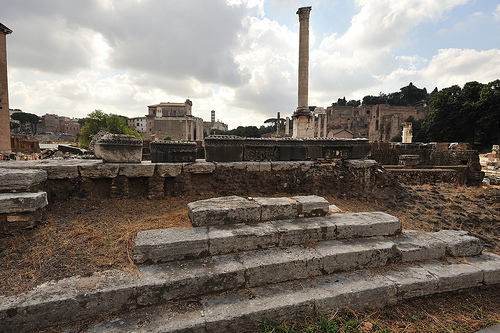


1. Via Sacra
"Arriving at the Via Sacra, turn right, heading toward the Arch of Septimius Severus."

Frommer's describes the Via Sacra as an ancient road that ran through the Forum.  Educating us on the original function of the Forum, Frommer's concludes that the site's dignity comes from what it represents: the austerity of Roman power.  This context provides us with a basis of understanding as we embark on our exploration of each ruin.


2. Basilica Aemilia
"The random columns on the right belong to the Basilica Aemilia."

"At the corner nearest the Forum entrance are some traces of melted bronze decoration that was fused to the marble floor during a great fire set by invading Goths in A.D. 410."

Our first stop on the tour is described by Frommer's as once being the site of great meeting halls and shops.


3. Curia, or Senate House
"The Curia, or Senate House is the large brick building on the right that still has its roof."
"The original floor of Egyptian marble and the tiers that held the seats of the senators have miraculously survived. In addition, at the far end of the great chamber we can see the stone on which rested the fabled golden statue of Victory."

The ancient function of this hall as a political meeting site is credited by Frommer's as influencing our present legislative system. A brief history of the Roman Senate is also given, to put the building in context.


4. Lapis Niger
"Head down the Curia stairs to the Lapis Niger. These are the remains of black marble blocks that reputedly mark the tomb of Romulus."

The limiting function of Google maps barred us from following Frommer's suggestion to go downstairs to the excavated tomb, which houses the oldest Latin inscription in existence. Nonetheless, the factual description of the Lapis Niger as Romulus' tomb marker will suffice to entice our interest.  However, a historical description here could help more ignorant travelers understand the tomb's importance.


5. Arch of Septimius Severus
"Across from the Curia, you'll see the Arch of Septimius Severus. The friezes on the arch depict victories over Arabs and Parthians."

This site, in contrast to Lapis Niger, is given a rich historical review, with Frommer's explaining that the arch was dedicated to the last decent emperor to govern Rome in the troubled 3rd century.  We can begin to understand how the Arch was patriotically constructed in a time where the Romans needed hope, as they fell into the hands of subsequent emperors.


 6. Rosta
"Amid the rubble, can be discerned a semicircular stair that led to the famous Rostra. This was the podium from which dictators and Caesars addressed the throngs on the Forum below."

Frommer's gives a detailed description of the Rosta's historical function, urging us to conceptualize how invigorating it would have been witness the emperor speaking on this podium to a mass of citizens.


7. Basilica Julia
"Going to the left, you'll come to the ruins of the Basilica Julia. Little more than a foundation remains."

We are informed that Julius Caesar dedicated the first structure, and the last one dates from the days after the Gothic invasion in A.D. 410.  It historically operated for the hearing of civil court cases, and Frommer's mentions it was notoriously hot in the summer months (something which we might empathize with if we were physically taking this tour, basking in the Roman sun).


8. Column Of Phocas
"Walking back down the ruined stairs of the Basilica Julia and into the broad area whose far side is bounded by the Curia, you'll see the Column of Phocas. Probably lifted from an early structure in the vicinity, this was the last monument to be erected in the Roman Forum."

To understand the importance of this column, Frommer's explains that it commemorates the Byzantine Emperor Phocas' generous donation to the pope of Rome, making it one of the few non-pagan buildings in the Forum.


9. Temple of Julius Casesar
"Now make your way down the middle of the Forum, nearly back to the ramp from which you entered. The pile of bricks with a semicircular indentation that stand in the middle of things was the Temple of Julius Caesar."

Since little remains of the original building, it is difficult to visualize how it may have looked and functioned in its time. Frommer's mentions that it was quite an elegant building, as confirmed by the reconstruction models.


10. Temple of the Castors
"With the entrance of the Forum to your left, you'll see on your right three columns originally belonging to the Temple of Castors."

The legend of twins Castor and Pollux is described by Frommer's, to help us understand why the Romans, specifically, would wish to dedicate a temple in their honour.


11. Temple of Vesta
"Within this circular monument dwelt the sacred flame of Rome and the Atrium of the Vestal Virgins."

Frommer's renders the ruins to be inconceivably rich in their time, and goes on to explain the culture of the Vestal Virgins who dwelt here.


12. Temple of Antoninus and Faustina
"With your back to the Palatine,  look beyond those fragmented statues of the former vestals to the Temple of Antoninus and Faustina. It's the building with the free-standing colonnade just to the right of the ramp where you first entered the Forum."

Inconsistent with the rest of the guide, not much historical context is given to this temple by Frommer's, which only mentions that the building behind it is a much later church, and the colonnade is the only thing dating from imperial times.


13. Temple of Romulus
"Head up the Via Sacra away from the entrance ramp toward the Arch of Titus. Pretty soon, on your left, you'll see the twin bronze doors of the Temple of Romulus."

Frommer's emphasizes the bronze doors, noting that they are the original.  A brief clarification that the temple was named for its builder, Emperor Maxentius' son, Romulus, is provided. Because Maxentius was threatened by future Christian emperor, Constantine, this building was erected in an attempt to dictate antiquarian patriotism. 


14. Basilica of Constantine
"Those three gaping arches up ahead on your left were part of the Basilica of Constantine."

 According to Frommer's, the scale of this basilica is consistent with the ego of the emperor with whose name it is affixed.  While he encourages us to admire the engineering skill of the building, we are forced to consider what this building would have represented for Constantine: reaffirmation of his power as the first Christian ruler of Rome.


15. The Arch of Titus
"Follow the Roman paving stones of Via Sacra to a low hill just ahead, where you'll find the Arch of Titus."

Serving as an alternate entrance to the Forum, the Arch of Titus marks our exit from the Forum.  In uniform with Frommer's description of the Arch of Septimius Severus, a background of Titus' influence as a victorious emperor confirms inspiration for this patriarchal arch.


WORKS CITED:
Darwin, Porter. "Frommer's Rome." www.frommers.com/destinations/rome.

IMAGES
Figure 1: https://picasaweb.google.com/lh/photo/xmSyex2Znx8qwDk2lsrieg
Figure 2. http://www.vroma.org/images/jwalker_images/jw-40.jpg
Figure 3. http://www.vroma.org/~forum/images/curia.good.jpg
Figure 4. http://upload.wikimedia.org/wikipedia/commons/thumb/a/a5/Inside_Restored_Senate_House%28Curia%29_FORUM_11Mar2006.JPG/400px-
Figure 5. Inside_Restored_Senate_House%28Curia%29_FORUM_11Mar2006.JPG.
Figure 6. http://upload.wikimedia.org/wikipedia/commons/thumb/a/a5/Inside_Restored_Senate_House%28Curia%29_FORUM_11Mar2006.JPG/400px-
Figure 7. Inside_Restored_Senate_House%28Curia%29_FORUM_11Mar2006.JPG.
Figure 8. https://ssl.panoramio.com/photo/80809496 
Figure 9. http://farm4.static.flickr.com/3121/2707870371_5b65c5b549.jpg
Figure 10. http://www.motorcyclemeanders.com/images/rome_forum_julia.JPG?513
Figure 11. http://farm1.static.flickr.com/131/323881672_4df2dae627.jpg
Figure 12. https://ssl.panoramio.com/photo/79814942
Figure 13. http://www.hitxp.com/pics/temple-of-vesta.jpg
Figure 14. http://static.flickr.com/111/266874480_bdc8b8b0d2_o.jpg
Figure 15. https://ssl.panoramio.com/photo/48633492
Figure 16. http://faculty.evansville.edu/rl29/art105/img/rome_constbasilica.jpg
Figure 17. http://wp.patheos.com.s3.amazonaws.com/blogs/markdroberts/files/2012/06/arch-titus-rome-8.jpg